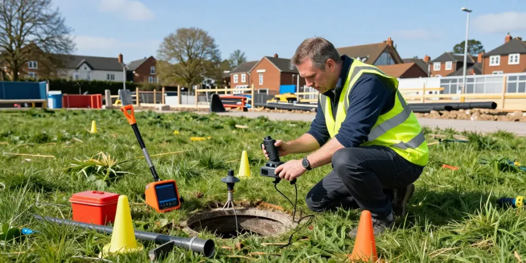
Understanding Utility Surveying in Surrey
Utility surveying is a critical aspect of modern construction and development, ensuring that underground utilities are accurately identified and mapped. In Surrey, where both urban and rural landscapes present unique challenges, the demand for comprehensive utility surveys has increased significantly. An effective Utility Survey Surrey not only aids in project planning but also prevents costly mistakes during excavation and construction. This article will explore the various facets of utility surveying, including its importance, methods, challenges, and best practices.
What is a Utility Survey?
A utility survey involves the detection, mapping, and analysis of underground utilities, such as water pipes, electricity cables, gas lines, and telecommunications infrastructure. Utility surveys are crucial for preventing damage to these assets during construction and maintenance work. They typically utilise advanced technologies to provide a comprehensive view of the subsurface landscape, ensuring safety and efficiency in construction projects.
Importance of Utility Mapping in Construction
The importance of utility mapping cannot be overstated. Precise utility surveys help anticipate potential issues, reduce the risk of accidents, and prevent delays in construction timelines. By having a clear understanding of the utilities in the area, contractors can make informed decisions, ensuring compliance with regulations while optimising project outcomes. Additionally, utility mapping assists in maintaining and upgrading existing infrastructure, leading to improved service delivery in communities.
Common Misconceptions About Utility Surveys
Despite their vital role, there are several misconceptions surrounding utility surveys. One common myth is that they are only necessary for large-scale infrastructure projects. In reality, even small construction projects can benefit from thorough utility mapping. Another misconception is that utility surveys can be performed without specialist equipment. Inaccurate results can arise from the use of inadequate tools, making professional surveys essential for accurate data.
Methods Used in Utility Surveys
Ground Penetrating Radar (GPR) Techniques
Ground Penetrating Radar (GPR) is one of the most effective methods employed in utility surveying. This non-invasive technology uses radar pulses to image the subsurface. GPR can detect a wide range of utilities, including those made from various materials, providing high-resolution images that help identify their location and depth. It is particularly advantageous in urban environments in Surrey, where numerous utilities may be intermingled.
Electromagnetic Locating Methods
Electromagnetic locating methods are also widely used in utility surveys. This technique involves sending an electromagnetic signal through the ground, which is then reflected back by buried utilities. It is highly effective for detecting metallic utilities such as pipes and cables. Additionally, these methods can complement GPR findings by verifying the location and status of utilities, ensuring comprehensive mapping.
When to Use Each Method in Surrey
The choice between GPR and electromagnetic locating methods often depends on the specific project requirements and site conditions. GPR is optimal when dealing with a variety of materials and when high-resolution images are needed, while electromagnetic methods are best for straightforward locations of metallic utilities. In many cases, a combination of both methods yields the most accurate results, providing a detailed overview of the underground infrastructure.
Challenges Faced in Utility Surveying
Identifying Complex Underground Networks
One of the primary challenges in utility surveying is identifying complex underground networks that have developed over time, particularly in urban areas of Surrey. The presence of multiple overlapping utilities can complicate mapping efforts and increase the chances of misidentification, leading to potential hazards during excavation.
Dealing with Historical Infrastructure
Many areas in Surrey contain historical infrastructure that may not be accurately represented in current maps. This can pose risks for modern construction projects, as unanticipated archaeological finds may halt work or require additional permits. Surveyors need to be adept at interpreting historical data and understanding the implications it has on current utility mapping.
Environmental Factors Affecting Surveys
Environmental conditions, such as soil composition, moisture levels, and even vegetation, can affect the accuracy of utility surveys. For instance, saturated soils may obscure GPR signals, while rocky terrains can cause signal refraction. Surveyors must consider these factors and leverage appropriate techniques to ensure data accuracy.
Best Practices for Conducting Utility Surveys
Planning and Preparation Steps
Effective utility surveying starts with meticulous planning. This includes conducting preliminary research to gather existing utility maps, engaging with local utility providers to identify known infrastructure, and thoroughly assessing the site conditions. The survey team should also ensure they have the appropriate equipment and trained personnel to handle the expected challenges.
Data Analysis and Interpretation
Once the data is collected, thorough analysis and interpretation are crucial. Surveying professionals must be skilled in interpreting the results from GPR and electromagnetic tools to create accurate maps. This includes distinguishing between different types of utilities and assessing their conditions. A well-analyzed utility survey will aid in decision-making for future project phases.
Reporting and Delivering Results
Clear communication of survey results is paramount. Comprehensive reports should detail the findings, including maps, data, and any potential issues. Effective reporting not only informs stakeholders but also ensures that the necessary precautions are taken during construction. Providing visual aids alongside written findings can enhance understanding for all parties involved.
Future Trends in Utility Surveying
Emerging Technologies in Utility Detection
The utility surveying industry is continuously evolving, with emerging technologies enhancing accuracy and efficiency. Innovations such as drone surveys, 3D scanning, and machine learning algorithms are set to transform how surveyors approach utility mapping. These technologies provide enhanced data collection capabilities and the potential for real-time analysis, reducing project timelines.
Predictions for Utility Surveying in 2026
By 2026, it is likely that utility surveying will embrace even more technological advancements, making surveys faster and more reliable. Increased automation and integration of geographic information systems (GIS) are expected to enhance data processing and accessibility. These innovations will enable surveyors to deliver more comprehensive and actionable insights to clients.
How to Stay Ahead in the Utility Surveying Industry
Staying updated with industry trends and continuously investing in training and equipment will be critical for surveyors looking to maintain a competitive edge. Professional development opportunities and networking within the industry can foster collaboration and innovation. Embracing new technologies and methodologies will allow surveying companies to meet evolving client needs effectively.
How much does a GPR survey cost?
The cost of a Ground Penetrating Radar (GPR) survey can vary significantly based on factors such as the survey area size, site accessibility, and the complexity of the underground utility networks. On average, clients can expect to pay between £500 to £2,000 for a comprehensive GPR survey. It's advisable to obtain multiple quotes from reputable surveying companies to ensure a fair price.
What is a utility survey?
A utility survey is a process of locating and mapping existing underground utilities before construction or excavation. This includes identifying the type, location, depth, and condition of utilities to prevent damage during construction activities.
Can I do my own boundary survey?
While property owners may attempt to mark their boundaries, it is generally advisable to hire professional surveyors who have the expertise and tools to conduct an accurate boundary survey. Professional surveys provide legally binding results that are crucial for resolving property disputes.
Who can mark underground utilities?
Only qualified professionals with the necessary training and certification in utility marking should perform this service. This includes utility surveyors or utility companies that are experienced in identifying and mapping underground facilities safely and accurately.
How accurate are utility surveys?
Utility surveys can achieve a high level of accuracy, often between 95-100%, depending on the methods used, site conditions, and the expertise of the surveyors. Nevertheless, factors such as environmental conditions and the presence of historical infrastructure can affect accuracy.